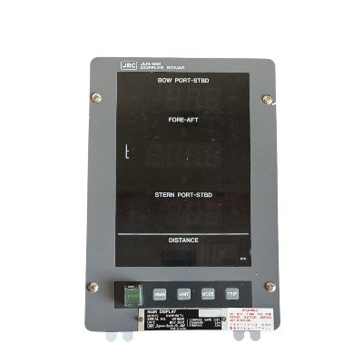
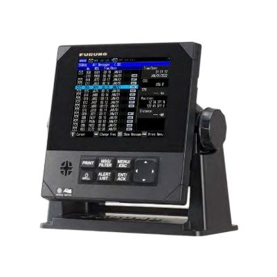
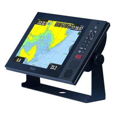
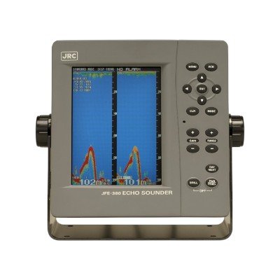
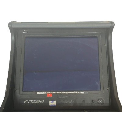
The FURUNO DS-30 Speed Log Display is the primary interface for the DS-30 Doppler Speed Log System. It features a high-contrast LCD screen that provides real-time, accurate readings of a vessel’s longitudinal (forward/backward) and transverse (sideways) speeds, along with distance run. Crucially, it offers graphical berthing data for precise maneuvering during docking. Designed for IMO-regulated vessels, this display is essential for safe navigation and integrates seamlessly with other bridge systems via NMEA 0183.
Technical Specification
- Display Type: 10-inch Color LCD (some older versions may have been monochrome)
- Resolution: Typically 640 x 480 pixels (VGA)
- Viewing Angle: Wide viewing angle for bridge visibility.
- Character Size: Selectable, often 15mm or 21mm high.
- Presentation Modes:
- Vessel Speed Display (Longitudinal & Transverse)
- Graphic Berthing Data (with predicted track marker)
- Graphic Navigation Data & Bottom Clearance / Under-Keel Clearance (UKC)
- Controls: Touch keys and/or trackball for operation.
- Panel Dimmer: Adjustable illumination for varying light conditions.
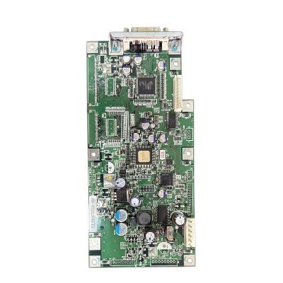
Speed & Distance Measurement (System Performance, driven by Transducer & Processor):
- Measuring System: Paired-beam Doppler Sonar
- Ultrasonic Frequency: 440 kHz (Tri-beam transducer)
- Speed Range (Longitudinal – Fore-AAft): -10.0 to +40.0 knots (through-the-water / over-ground)
- Speed Range (Transverse – Port-Starboard): -9.9 to +9.9 knots
- Distance Run: 0.00 to 999,999.99 nautical miles (resettable)
- Accuracy:
- Speed: pm1.0 or pm0.1 knots, whichever is greater (Ground-speed at high speed)
- Speed (low speed / berthing): pm2.0 or pm0.02 knots, whichever is greater (Ground-speed at low speed)
- Distance Run: pm1.0 or pm0.1 nautical miles, whichever is greater
- Note: Accuracy is subject to environmental conditions (e.g., shallow water effects, wind, current, tide, sensor location).
- Tracking Modes:
- Ground Tracking: 1 to 200 meters below hull bottom
- Water Tracking: 0.5 to 25 meters below hull bottom (typically 2 to 25 meters)
- Water Tracking Switching: Automatic or Manual
- Working Depth: Water depth greater than 3 meters beneath the keel required for reliable operation.
- Tide Speed and Direction: Displayed in relative or true bearing.
Interface & Connectivity:
- Serial Data Output (NMEA 0183):
- Multiple ports (typically 2-3 output, 1 input)
- IEC 61162-1 (NMEA 0183 Ver. 2.0 compatible, commonly outputs VBW, VLW sentences)
- Analog Outputs: Speed signals for analog displays (e.g., pm3.3textmA to 10textmA / pm10textkt to +30textkt)
- Distance Run Output: Contact closure pulses (e.g., one pulse per 0.005textNM)
- Input Sentences (IEC 61162-1): Supports various NMEA sentences for integration with other bridge systems (e.g., for GPS, Gyro, etc.).
- Optional Laser Gyro Interface (DS-340): For accurate transverse speed at stern in berthing mode, without requiring an additional transducer.
Power Supply (for the entire DS-30 system including display):
- System Source: AC 100/110/115/200/220/230V, 1 Phase, 50/60 Hz
- Power Consumption: Varies by system configuration and operational mode, but typically includes the Transceiver Unit, Signal Processor Unit, and Display Unit.
Environmental & Physical:
- Ambient Operating Temperature: -15°C to +55°C (for units in protected areas like the bridge).
- Relative Humidity: Up to 95% at 40°C.
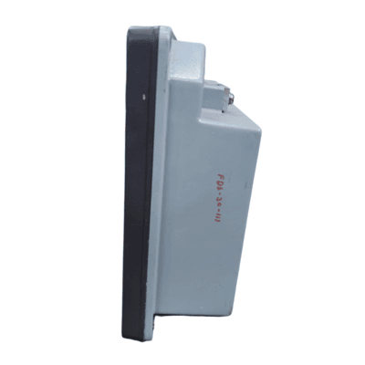
- Waterproofing (Display Unit):
- Front: IP56 (Protected against dust and strong jets of water)
- Back: IP22 (Protected against solid objects >12.5mm and dripping water)
- Compass Safe Distance: Typically 0.50m (standard) from the display unit.
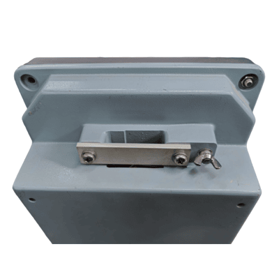
- Mounting: Designed for flush mounting in a console or bulkhead.
Compliance:
- IMO Resolution A.478(XII) (Performance Standard for Speed and Distance Measuring Equipment)
- IEC 61023 (Track Control Systems)
- IEC 60945 (General requirements for marine navigation equipment)


There are no reviews yet.