No products in the cart.
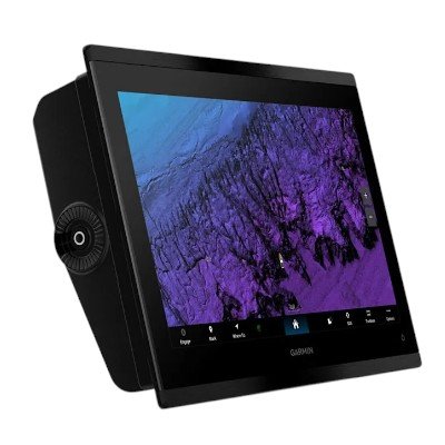
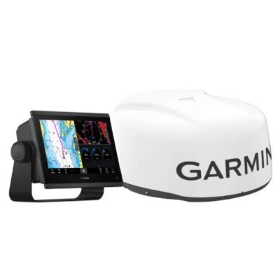
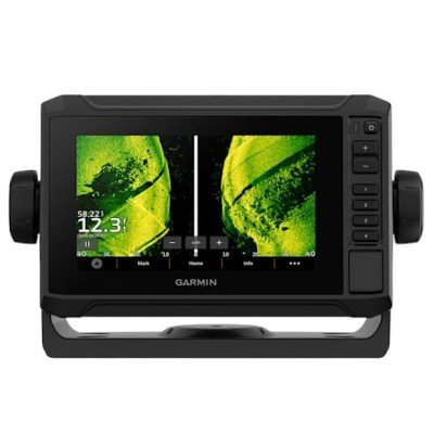
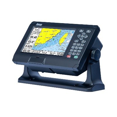
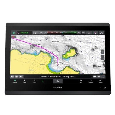
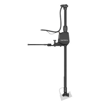
The Garmin GPSMAP® 9017 is a high-performance, 17-inch touchscreen MFD (Multi-Function Display) designed for integration into large offshore vessels. It is built for power, clarity, and extensive networking capabilities.
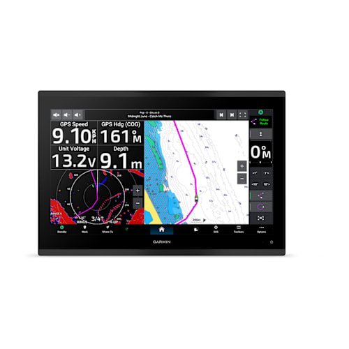
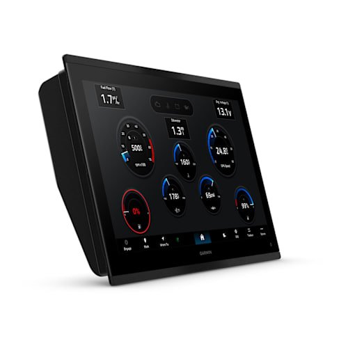
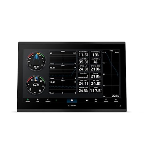
Display: 17-inch 4K resolution touchscreen with In-Plane Switching (IPS), providing consistent colors and visibility from all viewing angles, even with polarized sunglasses.
Processor: Features significantly upgraded processing speeds compared to previous generations, ensuring rapid map drawing and seamless data handling across the network.
Connectivity:
Garmin BlueNet™: High-speed network support for connecting multiple displays, radar, and sonar with minimal latency.
NMEA 2000® & NMEA 0183: Full integration for autopilots, engine data, and sensors.
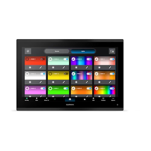
Video Integration: HDMI in/out and multiple IP camera support.
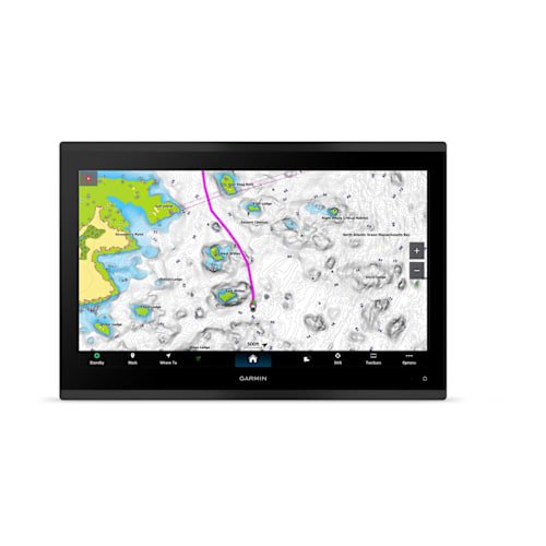
Navigation: Comes with a Worldwide Basemap. It is compatible with Garmin Navionics+™ and premium Garmin Navionics Vision+™ for high-resolution relief shading and Auto Guidance+™ technology.
Sonar Support: While it does not have a built-in sounder module, it fully integrates with external Garmin sonar modules (like the GSD™ series) for CHIRP, ClearVü, and SideVü scanning.
| Feature | Specification |
| Display Size | 17.25″ Diagonal (15.04″ x 8.5″) |
| Display Type | 4K IPS (In-Plane Switching) with Mini-LED local dimming |
| Resolution | 3840 x 2160 pixels |
| Dimensions | 16.8″ x 11.23″ x 3.6″ (42.7 x 28.5 x 9.2 cm) |
| Weight | 13.0 lbs (5.9 kg) |
| Water Rating | IPX7 |
| Mounting | Flat or Flush |
Processing Power: Up to 7x faster than previous generations for near-instant chart redraw and route calculation.
Networking: Utilizes the new Garmin BlueNet™ gigabit-speed architecture for high-bandwidth data (Radar, Video, Sonar).
Power Input: 10 to 32 Vdc
Typical Current Draw (12V): 4.3 A
Max Current Draw (12V): 4.9 A
Max Power Usage (10V): 52 W
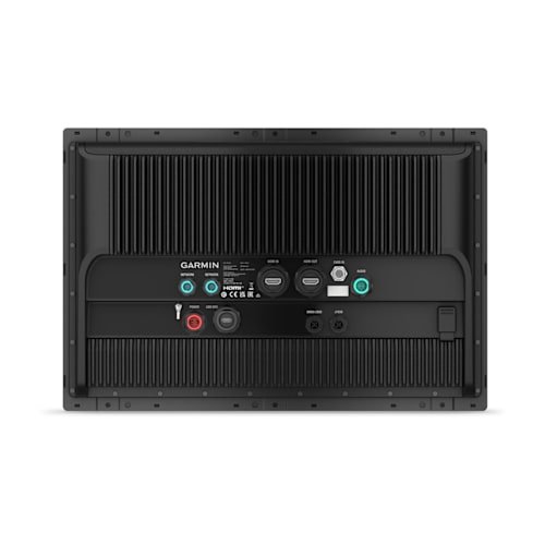
NMEA 2000: 1 Port
NMEA 0183: 1 Input (Rx) and 1 Output (Tx)
J1939 Port: 1 (for engine data integration)
BlueNet Ports: 2
Video I/O: * 1 HDMI In (HDCP compliant)
1 HDMI Out
1 BNC Composite Video In
USB: 1x USB-C
Wireless: Wi-Fi (2.4 & 5 GHz), Bluetooth, and ANT+
Internal Receiver: 10 Hz high-sensitivity (GPS, GLONASS, Galileo, BeiDou).
Multi-band GPS: Supports multi-band, multi-constellation for improved position accuracy in challenging environments.
Waypoints/Routes: 5,000 waypoints; 100 routes; 50,000 track points.
Chart Support: Garmin Navionics+ and Garmin Navionics Vision+ (Auto Guidance+ technology compatible).
Direct Support: Does not have a built-in sounder (unlike the 9017xsv model).
Network Support: Fully compatible with GCV™ or GSD™ black box sonar modules for CHIRP, SideVü, ClearVü, and LiveScope™.


There are no reviews yet.