No products in the cart.

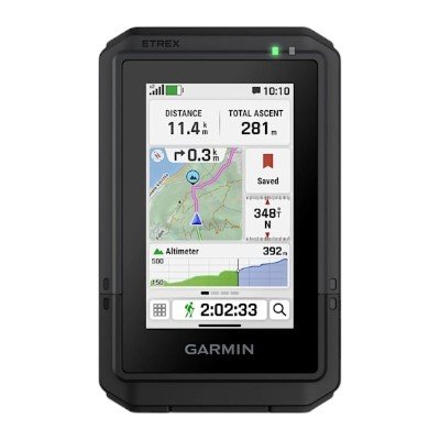
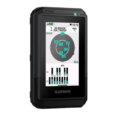
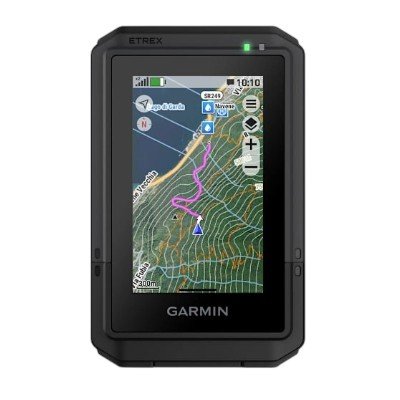
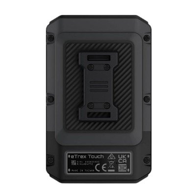
The Garmin eTrex® Touch GPS Handheld Navigator (Part Number 010-02940-01) is a compact, full-featured outdoor navigation device designed for hiking, cycling, geocaching, and off-grid exploration. Featuring a bright, 3-inch transflective color touchscreen (240 x 400 pixels) protected by chemically strengthened glass, it allows intuitive swipe and pinch-to-zoom mapping interactions in full sunlight. The unit comes preloaded with routable TopoActive maps for roads and trails, complete with terrain contours, elevations, waterways, and points of interest. Multi-band GNSS technology coupled with SatIQ™ optimization ensures exceptional positioning accuracy across multi-constellation satellite networks while conserving power.
General |
|
| LENS MATERIAL | Chemically strengthened glass |
|---|---|
| DIMENSION | 66 mm x 105.4 mm x 24.6 mm (2.6″ x 4.15″ x 0.97″) |
| WEIGHT | 150 g (5.3 oz) |
| WATER RATING | IPX7 |
| TOUCHSCREEN | ✓ |
| DISPLAY TYPE | 3″ transflective colour TFT |
| DISPLAY SIZE | 3.88 cm x 6.48 cm (1.53″ x 2.55″); 7.62 cm (3″) diag |
| DISPLAY RESOLUTION | 240 x 400 pixels |
| BATTERY TYPE | Rechargeable, internal lithium-ion |
| BATTERY LIFE | All Satellite Systems + Multi-Band: Up to 130 hours* Expedition Mode: up to 650 hours *Assuming typical use with SatIQ technology |
| MEMORY/HISTORY | 32 GB (user space varies based on included mapping) |
| INTERFACE | USB-C |
Maps & memory |
|
| PRELOADED MAPS | Yes (TopoActive, routable) |
|---|---|
| Ability to add maps | ✓ |
| BASEMAP | ✓ |
| Automatic routing (turn by turn routing on roads) for outdoor activities | ✓ |
| Map segments | Yes (15,000) |
| Satellite Imagery | Yes (via Outdoor Maps+ subscription) |
| Includes detailed hydrographic features (coastlines, lake/river shorelines, wetlands and perennial and seasonal streams) | ✓ |
| Includes searchable points of interests (parks, campgrounds, scenic lookouts and picnic sites) | ✓ |
| Displays national, state and local parks, forests, and wilderness areas | ✓ |
| WAYPOINTS | ✓ |
| COURSES | Unlimited |
| ACTIVITIES | Unlimited |
| Activity Profiles | ✓ |
| GPX imports | ✓ |
Sensors |
|
| GPS | ✓ |
|---|---|
| GALILEO | ✓ |
| QZSS | ✓ |
| BEIDOU | ✓ |
| IRNSS | ✓ |
| BAROMETRIC ALTIMETER | ✓ |
| COMPASS | ✓ |
| HIGH-SENSITIVITY RECEIVER | ✓ |
| GPS compass (while moving) | ✓ |
| Multi-band frequency | ✓ |
Daily smart features |
|
| CONNECT IQ™ (DOWNLOADABLE WATCH FACES, DATA FIELDS, WIDGETS AND APPS) | ✔ |
|---|---|
| SMART NOTIFICATIONS | ✔ |
| WEATHER FORECASTS | ✔ |
| Weather (removing Active) | ✔ |
| COMPATIBLE WITH GARMIN CONNECT™ MOBILE | ✔ |
| Garmin Share | ✔ |
| Passcode | ✔ |
| Next Word, Auto Complete, Auto Correct | Yes (Next Word, Auto Complete, Auto Correct) |
Safety and tracking features |
|
| LIVETRACK | ✔ |
|---|---|
Tactical features |
|
| Compatible with AB Synapse | ✔ |
|---|---|
| BALLISTICS SOLVER | Yes (unlock required) |
| Dual grid coordinates | ✓ |
| NIGHT VISION MODE | ✓ |
Outdoor Recreation |
|
| POINT-TO-POINT NAVIGATION | ✔ |
|---|---|
| TRACBACK® | ✔ |
| AREA CALCULATION | ✔ |
| SUN AND MOON INFORMATION | ✔ |
| Geocaching-friendly | Yes (Geocache Live) |
| Custom maps compatible | Yes (500 custom map tiles) |
| Picture viewer | |
Outdoor applications |
|
| Compatible with Garmin Explore™ app | ✓ |
|---|---|
| GARMIN EXPLORE WEBSITE COMPATIBLE | ✓ |
Connections |
|
| CONNECTIONS WIRELESS CONNECTIVITY | Yes (Wi-Fi®, BLE, ANT®) |
|---|---|



There are no reviews yet.