No products in the cart.
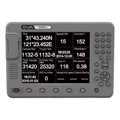
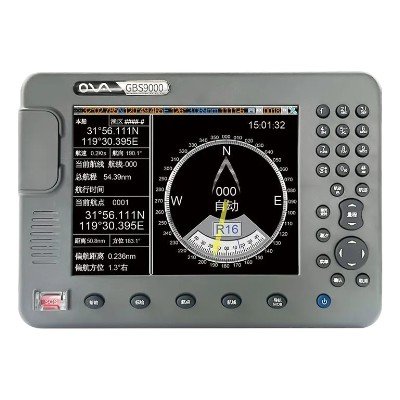
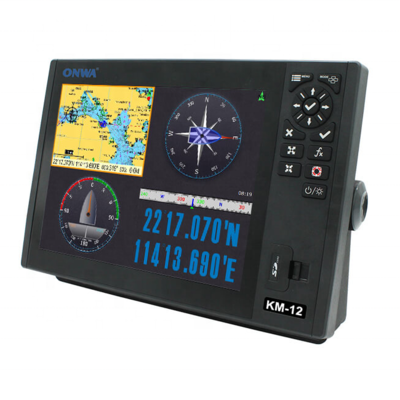
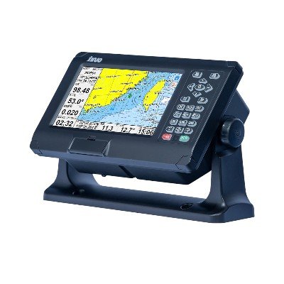
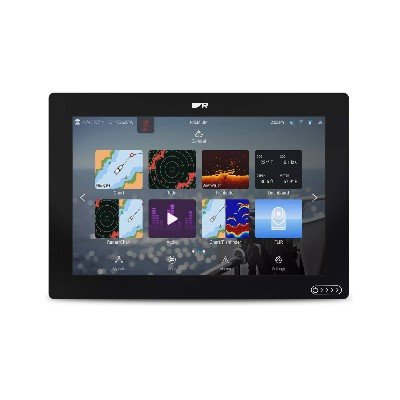
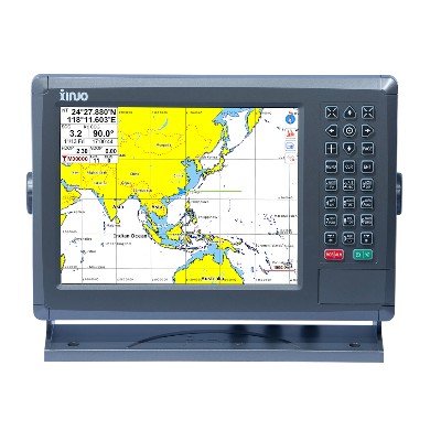
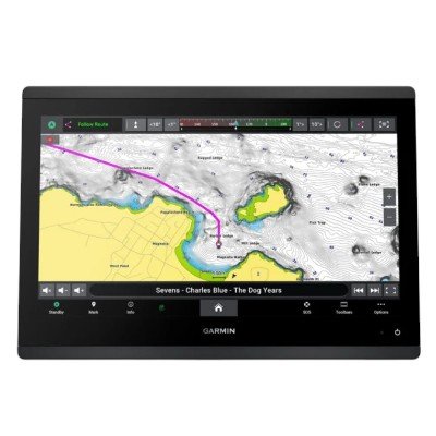
The GBS9000 (often referred to as the OVA GBS9000-08) is a professional 8-inch Marine GNSS Navigator and Chart Plotter. It is a rugged, industrial-grade device designed for commercial fishing, inland transport, and ocean-going vessels. It is frequently recognized for its independent GPS/BeiDou receiver technology, which provides high stability in speed and course data.
The GBS9000-08 serves as a central navigation hub. Unlike standard consumer GPS units, it is built with high-performance isolated power supplies to prevent electrical interference and is certificated by the China Classification Society (CCS) for professional use.
Multi-GNSS Support: Simultaneously tracks GPS, BeiDou, GLONASS, and Galileo constellations for a faster and more reliable position fix.
Advanced Filtering: Uses proprietary “Speed and Heading” filtering technology to ensure the on-screen data remains stable even in rough sea conditions.
Smart Display Modes: Features four dedicated color modes (Sunny, Cloudy, Dusk, and Night) that can automatically switch based on sunrise/sunset times.
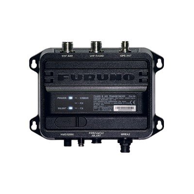
AIS Integration: When connected to an AIS receiver, it can display AIS targets and manage vessel lists, providing collision avoidance alarms.
Industrial Construction: Waterproof, sunlight-viewable, and unaffected by water temperature or salinity, though it is recommended for bracket or flush mounting in protected or semi-protected areas.
| Category | Feature | Specification |
| Display | Screen Size | 8-inch Color TFT LCD |
| Resolution | 800 x 600 pixels (SVGA) | |
| Waterproofing | IPX6 (Front Panel) | |
| Brightness | High-contrast, sunlight-viewable | |
| GNSS Receiver | Receiver Type | GPS, GLONASS, Galileo, BeiDou (B1) |
| Accuracy | GPS: < 13m / BeiDou: < 25m (Horizontal) | |
| Acquisition | Cold Start: 45s / Hot Start: 15s | |
| Sensitivity | Acquisition: -130dBm to -120dBm | |
| Navigation | Waypoints | 6,000 points |
| Routes | 200 routes (up to 48 waypoints each) | |
| Track Memory | 20,000 track points | |
| Marks | 5,000 points | |
| Connectivity | I/O Format | NMEA0183 (GGA, GSA, GLL, GSV, RMC, VTG) |
| AIS Input | Support for VDM sentences | |
| Storage | SD Card slot for software/chart updates and data backup | |
| Power | Voltage | 12–24 VDC (Range: 11V to 35V) |
| Consumption | 15W + 1W | |
| Physical | Mounting | Bracket Mount or Flush Mount |


There are no reviews yet.